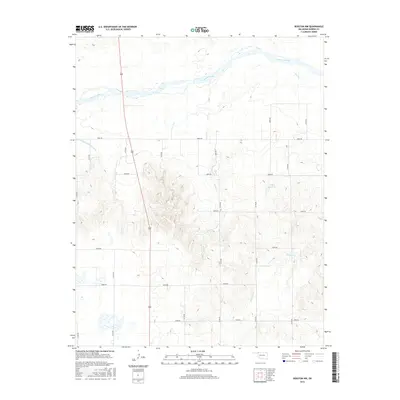
2016 Map of Rosston NW
USGS Topo · Published 2016About this map
The Cimarron River dominates the northern reaches of this northwest Oklahoma landscape, where the braided riverbed cuts through the high plains of Harper County. In the northwestern corner, the Old Settlers Irrigation Ditch provides a concrete record of early agricultural water management efforts in this arid region. The terrain is characterized by a grid of section-line roads, such as N1700 Rd and E0040 Rd, which define the ranching and farming parcels of the area. Away from the river, the hydrology includes several seasonal drainages and small impoundments like Casey Reservoir. The course of Stink Cr and Redoubt Cr wind through the southern sections, illustrating the natural drainage patterns that have shaped the local topography and dictated road placements for generations of residents.
Find a feature on this map
21 named features on this map. Tap any name to fly to it.
Don’t see what you’re looking for? This feature index may not catch every label — zoom into the map to look around manually.
Map Details
Editions of this 2016 Rosston NW Map
This is the sole edition of this map. No revisions or reprints were ever made.
Other maps of this area

1892 · Meade
USGS Topo · 1:125,000

1896 · Ashland
USGS Topo · 1:125,000

1954 · Perryton
USGS Topo · 1:250,000

1955 · Woodward
USGS Topo · 1:250,000

1955 · Pratt
USGS Topo · 1:250,000

1955 · Dodge City
USGS Topo · 1:250,000

1958 · Perryton
USGS Topo · 1:250,000

1958 · Woodward
USGS Topo · 1:250,000

1958 · Dodge City
USGS Topo · 1:250,000

1959 · Pratt
USGS Topo · 1:250,000