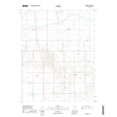
2018 Map of Rosston NW
USGS Topo · Published 2018About this map
The Cimarron River winds through the northern portion of this Harper County landscape, defining the local hydrology alongside several smaller tributaries and managed water sources. The presence of the Old Settlers Irrigation Ditch reflects the area's agricultural heritage and the historical necessity of diverting water in western Oklahoma. Further south, the terrain is shaped by the drainages of Stink Cr and Redoubt Cr, which carve through the plains. Several localized reservoirs, including Casey Reservoir and numerous numbered basins like 059037 Reservoir, indicate a modern landscape heavily focused on water storage and land management. A precise grid of section roads, such as N1740 Rd and E0050 Rd, provides access across the township lines of t29n r25w and its neighbors.
Find a feature on this map
28 named features on this map. Tap any name to fly to it.
Don’t see what you’re looking for? This feature index may not catch every label — zoom into the map to look around manually.
Map Details
Editions of this 2018 Rosston NW Map
This is the sole edition of this map. No revisions or reprints were ever made.
Other maps of this area

1892 · Meade
USGS Topo · 1:125,000

1896 · Ashland
USGS Topo · 1:125,000

1954 · Perryton
USGS Topo · 1:250,000

1955 · Woodward
USGS Topo · 1:250,000

1955 · Pratt
USGS Topo · 1:250,000

1955 · Dodge City
USGS Topo · 1:250,000

1958 · Perryton
USGS Topo · 1:250,000

1958 · Woodward
USGS Topo · 1:250,000

1958 · Dodge City
USGS Topo · 1:250,000

1959 · Pratt
USGS Topo · 1:250,000