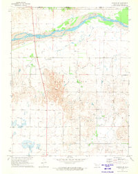
1970 Map of Rosston NW
USGS Topo · Published 1973About this map
The Cimarron River winds through this Northwest Oklahoma landscape just south of the Kansas border, defining a region where water management and energy extraction are central to the landscape. To the north, the riverbed dominates the terrain, while the central and southern sections are marked by the Old Settlers Irrigation Ditch and numerous industrial sites. The presence of the Ditch Valley Community Building suggests a localized social hub for the rural residents of the Garfield township area.
Find a feature on this map
12 named features on this map. Tap any name to fly to it.
Don’t see what you’re looking for? This feature index may not catch every label — zoom into the map to look around manually.
Map Details
Editions of this 1970 Rosston NW Map
This is the sole edition of this map. No revisions or reprints were ever made.
Other maps of this area

1892 · Meade
USGS Topo · 1:125,000

1896 · Ashland
USGS Topo · 1:125,000

1954 · Perryton
USGS Topo · 1:250,000

1955 · Woodward
USGS Topo · 1:250,000

1955 · Pratt
USGS Topo · 1:250,000

1955 · Dodge City
USGS Topo · 1:250,000

1958 · Perryton
USGS Topo · 1:250,000

1958 · Woodward
USGS Topo · 1:250,000

1958 · Dodge City
USGS Topo · 1:250,000

1959 · Pratt
USGS Topo · 1:250,000