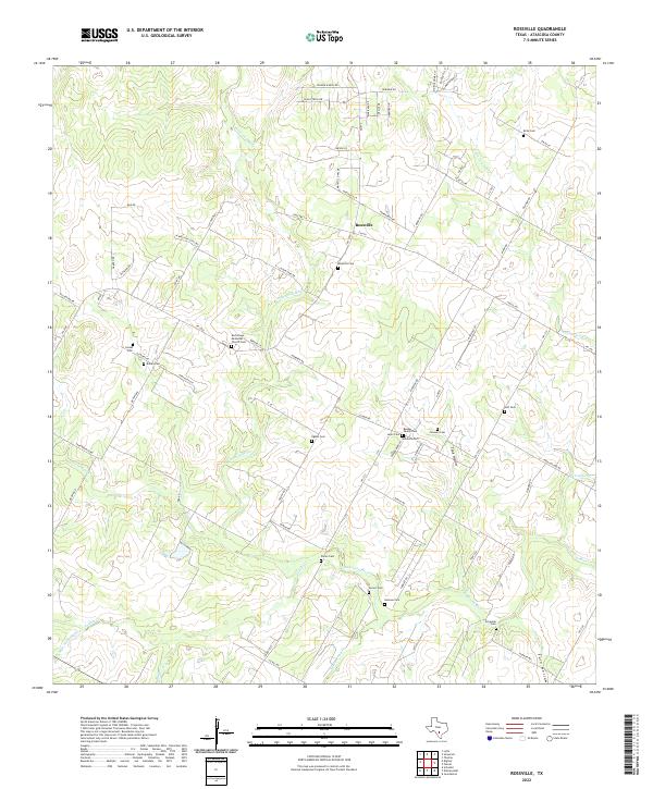
2022 Map of Rossville
USGS Topo · Published 2022About this map
Rossville serves as the central hub of this Atascosa County landscape, where the Atascosa River winds through a terrain marked by deep-rooted family history. The sheer density of small family burial grounds and community cemeteries, such as the Bender Family Cem and Layer Cem, suggests a legacy of early Texas ranching and settlement patterns that persisted long after the town's initial founding. Narrow corridors like FM 476 and FM 1333 connect these rural enclaves, tracing paths between landmarks like the Anchorage Methodist Church Cem. Along the eastern edge, topographical features like Tank Hollow and Fern Hollow frame the drainages of Agua Negra Cr and Palo Alto Cr. This survey documents a quiet rural area where the placement of legacy sites like Grosco Cem and Vanness Cem remains integral to the local geography.
Find a feature on this map
85 named features on this map. Tap any name to fly to it.
Don’t see what you’re looking for? This feature index may not catch every label — zoom into the map to look around manually.
Map Details
Editions of this 2022 Rossville Map
This is the sole edition of this map. No revisions or reprints were ever made.
Other maps of this area

1934 · Schattel
USGS Topo · 1:62,500

1942 · Natalia
USGS Topo · 1:62,500

1953 · Crystal City
USGS Topo · 1:250,000

1954 · San Antonio
USGS Topo · 1:250,000

1955 · Crystal City
USGS Topo · 1:250,000

1956 · Jourdanton
USGS Topo · 1:62,500

1957 · San Antonio
USGS Topo · 1:250,000

1958 · Somerset
USGS Topo · 1:24,000

1958 · Thelma
USGS Topo · 1:24,000

1961 · Crystal City
USGS Topo · 1:250,000