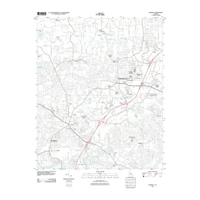
2011 Map of Roswell
USGS Topo · Published 2011About this map
Alpharetta and Roswell anchor this northern Georgia landscape, showing a dense network of suburban development and civic infrastructure at the start of the 2010s. The map captures a transition from older settlement patterns, evidenced by family and community landmarks like the Lebanon Cemetery and Crabapple Baptist Cemetery, to modern commercial and educational hubs such as the Strayer University Roswell Campus.
Find a feature on this map
97 named features on this map. Tap any name to fly to it.
Don’t see what you’re looking for? This feature index may not catch every label — zoom into the map to look around manually.
Map Details
Editions of this 2011 Roswell Map
This is the sole edition of this map. No revisions or reprints were ever made.
Other maps of this area

1888 · Atlanta
USGS Topo · 1:125,000

1890 · Suwanee
USGS Topo · 1:125,000

1890 · Atlanta
USGS Topo · 1:125,000

1892 · Atlanta
USGS Topo · 1:125,000

1894 · Suwanee
USGS Topo · 1:125,000

1895 · Atlanta
USGS Topo · 1:125,000

1953 · Atlanta
USGS Topo · 1:250,000
1954 · Chamblee
USGS Topo · 1:24,000

1955 · Rome
USGS Topo · 1:250,000
1955 · Sandy Springs
USGS Topo · 1:24,000