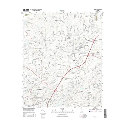
2014 Map of Roswell
USGS Topo · Published 2014About this map
The Chattahoochee River forms the southern boundary of this North Georgia corridor, where suburban expansion meets long-standing rural community centers. Small settlements like Fields Crossroads, Crabapple, and Newtown punctuate a landscape increasingly defined by planned residential developments such as Sterling Heights, Andover North, and Wedgewood Forest. The map reveals a dense network of local history through its numerous burial grounds, including the Crabapple Baptist Cem and Ebenezer Cem, alongside civic hubs like Alpha Park.
Find a feature on this map
55 named features on this map. Tap any name to fly to it.
Don’t see what you’re looking for? This feature index may not catch every label — zoom into the map to look around manually.
Map Details
Editions of this 2014 Roswell Map
This is the sole edition of this map. No revisions or reprints were ever made.
Other maps of this area

1888 · Atlanta
USGS Topo · 1:125,000

1890 · Suwanee
USGS Topo · 1:125,000

1890 · Atlanta
USGS Topo · 1:125,000

1892 · Atlanta
USGS Topo · 1:125,000

1894 · Suwanee
USGS Topo · 1:125,000

1895 · Atlanta
USGS Topo · 1:125,000

1953 · Atlanta
USGS Topo · 1:250,000

1954 · Chamblee
USGS Topo · 1:24,000

1955 · Rome
USGS Topo · 1:250,000
1955 · Sandy Springs
USGS Topo · 1:24,000