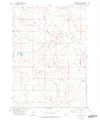
1978 Map of Roswell
USGS Topo · Published 1978About this map
The South Fork Moreau River and the North Fork Moreau River converge in this high plains landscape of Harding County, defining a complex drainage system characterized by numerous intermittent draws and creeks. This 1970s survey illustrates a region where water management is central to the land's utility, marked by features such as Soft Water Draw, Stockade Draw, and Swallow Draw. The terrain is punctuated by isolated elevations including Roundup Butte and the Ferguson Buttes, which serve as primary landmarks in an otherwise open range. The network of unnamed wells and stock ponds scattered across the quadrangle indicates a landscape heavily utilized for livestock, where every Well and water source was essential for sustaining herds. Tracing the courses of Goose Creek and Duck Creek reveals how the natural topography dictated the placement of ranching infrastructure and boundary lines during this era.
Find a feature on this map
17 named features on this map. Tap any name to fly to it.
Don’t see what you’re looking for? This feature index may not catch every label — zoom into the map to look around manually.
Map Details
Editions of this 1978 Roswell Map
This is the sole edition of this map. No revisions or reprints were ever made.
Other maps of this area

1899 · Alexandria
USGS Topo · 1:125,000

1899 · De Smet
USGS Topo · 1:125,000

1953 · Watertown
USGS Topo · 1:250,000

1955 · Sioux Falls
USGS Topo · 1:250,000

1958 · Sioux Falls
USGS Topo · 1:250,000

1958 · Watertown
USGS Topo · 1:250,000

1971 · Howard NE
USGS Topo · 1:24,000

1971 · Fedora
USGS Topo · 1:24,000

1971 · Artesian NE
USGS Topo · 1:24,000

1971 · Howard
USGS Topo · 1:24,000