
1919 Map of Rosy
USGS Topo · Published 1919About this map
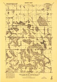
Chippewa Indian Reservation lands and the adjacent Dixon Indian Reservation dominate this Northern Minnesota landscape during a period of transition in land use and drainage. The survey illustrates an extensive network of drainage ditches, such as those alongside State Road No. 19 and State Road No. 20, reflecting early twentieth-century efforts to reclaim wetland for agriculture or timber. Small settlements like Alvwood, Rosy, and Louis anchor the remote grid, while numerous unnamed schools are scattered near the banks of the Third River. Large bodies of water, including Moose Lake, Decker Lake, and the northern reaches of Winnibigoshish Lake, define the local topography. This military-compiled sheet also identifies several townships and the 12th Standard Parallel North, providing a detailed view of the Beltrami and Itasca County border region.
Find a feature on this map
28 named features on this map. Tap any name to fly to it.
Don’t see what you’re looking for? This feature index may not catch every label — zoom into the map to look around manually.
Map Details
Editions of this 1919 Rosy Map
2 editions found
Other maps of this area

1919 · Gemmell
USGS Topo · 1:62,500

1919 · Quiring
USGS Topo · 1:62,500

1919 · Max
USGS Topo · 1:62,500

1919 · Bridgie
USGS Topo · 1:62,500

1924 · Bridgie
USGS Topo · 1:62,500

1954 · Bemidji
USGS Topo · 1:250,000

1957 · Bemidji
USGS Topo · 1:250,000

1958 · Bemidji
USGS Topo · 1:250,000

1971 · Squaw Lake
USGS Topo · 1:24,000

1971 · Dixon Lake
USGS Topo · 1:24,000