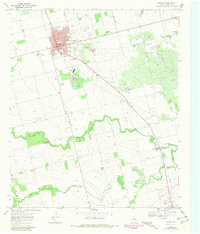
1969 Map of Rotan
USGS Topo · Published 1981About this map
Rotan serves as the primary hub of this West Texas landscape, defined by its grid of streets and significant industrial infrastructure. The local economy in the late 1960s is anchored by a large Gypsum Plant and an extensive network of oil wells and pipelines. To the south, the terrain becomes more varied as it approaches the Clear Fork Brazos River, where the Gaging Sta monitors the waterway. Smaller settlements and named locales like North Roby and Sardis dot the surrounding ranch land and river bottom.
Find a feature on this map
21 named features on this map. Tap any name to fly to it.
Don’t see what you’re looking for? This feature index may not catch every label — zoom into the map to look around manually.
Map Details
Editions of this 1969 Rotan Map
2 editions found
Other maps of this area

1893 · Roby
USGS Topo · 1:125,000

1926 · Snyder 1-a
USGS Topo · 1:48,000

1926 · Roby 2-b
USGS Topo · 1:48,000

1931 · Rotan
USGS Topo · 1:62,500

1932 · Camp Springs
USGS Topo · 1:62,500

1954 · Big Spring
USGS Topo · 1:250,000

1958 · Big Spring
USGS Topo · 1:250,000
1969 · White Canyon
USGS Topo · 1:24,000
1969 · Poke Mountain
USGS Topo · 1:24,000

1969 · Rotan
USGS Topo · 1:24,000