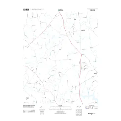
2013 Map of Rougemont
USGS Topo · Published 2013About this map
Rougemont and the nearby peak of Red Mountain anchor this landscape in northern Durham County, where the topography is defined by the headwaters of several major river systems. The Flat River winds through the northeast corner near the George K Slocum Forestry Camp, while branches of the Little River move across the southern half of the quadrangle. Several significant water bodies, including Lake Rogers, Lake Orange, and Gantt Lake, suggest a region managed for both municipal resources and recreation.
Find a feature on this map
152 named features on this map. Tap any name to fly to it.
Don’t see what you’re looking for? This feature index may not catch every label — zoom into the map to look around manually.
Map Details
Editions of this 2013 Rougemont Map
This is the sole edition of this map. No revisions or reprints were ever made.
Other maps of this area

1943 · Roxboro
USGS Topo · 1:62,500

1951 · Durham North
USGS Topo · 1:62,500

1953 · Greensboro
USGS Topo · 1:250,000

1954 · Greensboro
USGS Topo · 1:250,000

1962 · Greensboro
USGS Topo · 1:250,000

1966 · Greensboro
USGS Topo · 1:250,000
1968 · Hillsborough
USGS Topo · 1:24,000

1968 · Caldwell
USGS Topo · 1:24,000

1968 · Hurdle Mills
USGS Topo · 1:24,000
1973 · Northeast Durham
USGS Topo · 1:24,000