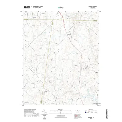
2019 Map of Rougemont
USGS Topo · Published 2019About this map
Rougemont and Bahama anchor this North Carolina landscape where the borders of Durham, Orange, and Person Counties converge. The terrain is defined by the headwaters of the Little River and its various branches, including the South Fork Little River and North Fork Little River. Significant water bodies like Lake Orange, Lake Rogers, and McFarland Lake are prominent, illustrating the region's managed water resources for recreation and local utility.
Find a feature on this map
133 named features on this map. Tap any name to fly to it.
Don’t see what you’re looking for? This feature index may not catch every label — zoom into the map to look around manually.
Map Details
Editions of this 2019 Rougemont Map
This is the sole edition of this map. No revisions or reprints were ever made.
Other maps of this area

1943 · Roxboro
USGS Topo · 1:62,500

1951 · Durham North
USGS Topo · 1:62,500

1953 · Greensboro
USGS Topo · 1:250,000

1954 · Greensboro
USGS Topo · 1:250,000

1962 · Greensboro
USGS Topo · 1:250,000

1966 · Greensboro
USGS Topo · 1:250,000
1968 · Hillsborough
USGS Topo · 1:24,000

1968 · Caldwell
USGS Topo · 1:24,000

1968 · Hurdle Mills
USGS Topo · 1:24,000
1973 · Northeast Durham
USGS Topo · 1:24,000