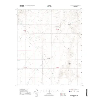
2020 Map of Rough and Ready Hills
USGS Topo · Published 2020About this map
The Rough and Ready Hills define this high-desert landscape in Doña Ana County, where a network of dry washes and canyons carve through the terrain. Evidence of water management for ranching and land use is found throughout the area, marked by features such as Silva Tank, Adobe Tank, and the larger McCall Reservoir. The map shows a series of prominent elevations, from Bell Top Mtn in the northwest to the Cedar Hills along the eastern margin, interconnected by deep drainages like Silva Canyon and Foster Canyon. Significant tracks through the brush, such as Co RD e011 and Co RD d012, provide the primary access through these hills, while local landmarks like Marijuana Tank and Candler Draw reflect the specific nomenclature of this Southwestern territory.
Find a feature on this map
24 named features on this map. Tap any name to fly to it.
Don’t see what you’re looking for? This feature index may not catch every label — zoom into the map to look around manually.
Map Details
Editions of this 2020 Rough and Ready Hills Map
This is the sole edition of this map. No revisions or reprints were ever made.
Other maps of this area

1891 · Las Cruces
USGS Topo · 1:125,000

1893 · Las Cruces
USGS Topo · 1:125,000

1916 · Tonuco
USGS Topo · 1:125,000

1932 · Tonuco
USGS Topo · 1:125,000

1941 · Las Cruces
USGS Topo · 1:62,500

1943 · Corralitos Ranch
USGS Topo · 1:62,500

1943 · Las Cruces
USGS Topo · 1:62,500

1948 · San Diego Mountain
USGS Topo · 1:62,500

1955 · Las Cruces
USGS Topo · 1:250,000

1958 · Las Cruces
USGS Topo · 1:250,000