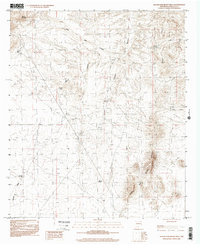
2001 Map of Rough And Ready Hills
USGS Topo · Published 2001About this map
The Rough and Ready Hills dominate the southeastern portion of this Doña Ana County landscape, rising out of a terrain carved by numerous drainages. These arid uplands are defined by a network of seasonal water sources and canyons, including the prominent Lloyd Canyon and Coyote Canyon. The presence of small-scale water management is evident through various tanks and reservoirs, such as Silva Tank, Mc Call Reservoir, and the curiously named Marijuana Tank. These features suggest a landscape managed for livestock or local water needs in a region where moisture is scarce. Small settlements or localized family sites like Silva appear near Coyote Tank, while Bell Top Mountain provides a distinct landmark in the northwestern corner. The map traces the natural flow of the land through features like Candler Draw and Faulkner Canyon, documenting the fundamental environmental constraints and human adaptations in this part of New Mexico.
Find a feature on this map
15 named features on this map. Tap any name to fly to it.
Don’t see what you’re looking for? This feature index may not catch every label — zoom into the map to look around manually.
Map Details
Editions of this 2001 Rough And Ready Hills Map
This is the sole edition of this map. No revisions or reprints were ever made.
Other maps of this area

1891 · Las Cruces
USGS Topo · 1:125,000

1893 · Las Cruces
USGS Topo · 1:125,000

1916 · Tonuco
USGS Topo · 1:125,000

1932 · Tonuco
USGS Topo · 1:125,000

1941 · Las Cruces
USGS Topo · 1:62,500

1943 · Corralitos Ranch
USGS Topo · 1:62,500

1943 · Las Cruces
USGS Topo · 1:62,500

1948 · San Diego Mountain
USGS Topo · 1:62,500

1955 · Las Cruces
USGS Topo · 1:250,000

1958 · Las Cruces
USGS Topo · 1:250,000