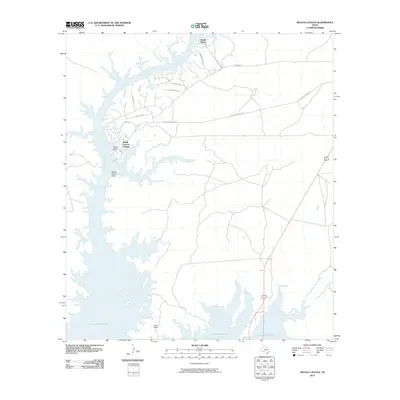
2010 Map of Rough Canyon
USGS Topo · Published 2010About this map
Amistad Reservoir dominates this landscape where the Devils River feeds into the expansive waterway at the Rough Canyon Cliffs. The settlement of Rough Canyon Colonia sits near the water's edge, supported by the Rough Canyon Marina, which serves as a central hub for activity in this part of Val Verde County. To the north, the small community of Devils Shores is situated along the river banks near Sanders Point Rd. This 2010 survey illustrates a modern recreation-centered economy, defined by winding residential streets like Puma Dr and Longhorn Dr that branch off from St Recreational Rd 2. The terrain transitions from high points like Long Point down to the submerged valleys of the North Fork San Pedro Creek, documenting the shoreline as it appeared in the early 21st century.
Find a feature on this map
17 named features on this map. Tap any name to fly to it.
Don’t see what you’re looking for? This feature index may not catch every label — zoom into the map to look around manually.
Map Details
Editions of this 2010 Rough Canyon Map
This is the sole edition of this map. No revisions or reprints were ever made.
Other maps of this area

1941 · Feely
USGS Topo · 1:62,500

1943 · Devils River
USGS Topo · 1:62,500

1943 · Del Rio
USGS Topo · 1:62,500

1944 · Devils River
USGS Topo · 1:62,500

1944 · Devils Lake
USGS Topo · 1:62,500

1958 · Del Rio
USGS Topo · 1:250,000

1964 · Del Rio
USGS Topo · 1:250,000

1972 · Amistad Dam
USGS Topo · 1:24,000

1972 · California Creek
USGS Topo · 1:24,000

1972 · Miers Ranch
USGS Topo · 1:24,000