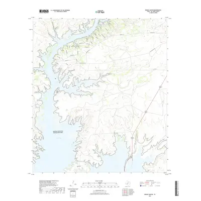
2019 Map of Rough Canyon
USGS Topo · Published 2019About this map
Amistad National Recreation Area defines this arid Val Verde County landscape, where the rising waters of Walk Lake fill the deep limestone incisions of the Devils River arm. This 2019 survey captures the modern road network of the Devils Shores developments, including Rio Diablo Pkwy and St Recreational Rd 2, which provide access to the waterfront recreation sites. Significant terrain features such as the Rough Canyon Cliffs and Long Point rise above the complex shoreline, illustrating the dramatic verticality of the canyon system. The map documents the drainage patterns of Twin Canyons and Windmill Canyon, alongside smaller waterways like N Fork San Pedro Cr. Local navigation is marked by specific residential and access routes like Diablo Rd and Devils Clf, serving as a contemporary record of the region's land use.
Find a feature on this map
35 named features on this map. Tap any name to fly to it.
Don’t see what you’re looking for? This feature index may not catch every label — zoom into the map to look around manually.
Map Details
Editions of this 2019 Rough Canyon Map
This is the sole edition of this map. No revisions or reprints were ever made.
Other maps of this area

1941 · Feely
USGS Topo · 1:62,500

1943 · Devils River
USGS Topo · 1:62,500

1943 · Del Rio
USGS Topo · 1:62,500

1944 · Devils River
USGS Topo · 1:62,500

1944 · Devils Lake
USGS Topo · 1:62,500

1958 · Del Rio
USGS Topo · 1:250,000

1964 · Del Rio
USGS Topo · 1:250,000

1972 · Amistad Dam
USGS Topo · 1:24,000

1972 · California Creek
USGS Topo · 1:24,000

1972 · Miers Ranch
USGS Topo · 1:24,000