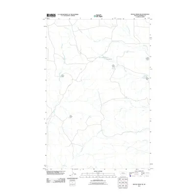
2011 Map of Rough Creek NE
USGS Topo · Published 2011About this map
The seasonal waterways of Rough Creek and its many tributaries characterize this part of Rosebud County during the early 21st century. The landscape is defined by a complex network of drainage basins, where intermittent streams like Ryans Fork, Upper Coal Creek, and Dog Creek carve through the terrain. A distinctive element of this era's land management is the series of numbered water control structures, including Hook Number 3 Dam and Hook Number 8 Dam, which likely support local ranching operations in this arid region. The central focal point of water storage is Trail Creek Reservoir, held by the Trail Creek Dam. Transportation is limited to remote corridors like RD 203, reflecting the low-density, agricultural character of the high plains north of the Yellowstone River.
Find a feature on this map
16 named features on this map. Tap any name to fly to it.
Don’t see what you’re looking for? This feature index may not catch every label — zoom into the map to look around manually.
Map Details
Editions of this 2011 Rough Creek NE Map
This is the sole edition of this map. No revisions or reprints were ever made.
Other maps of this area

1954 · Forsyth
USGS Topo · 1:250,000

1957 · Forsyth
USGS Topo · 1:250,000

1958 · Forsyth
USGS Topo · 1:250,000

1965 · Needle Butte Reservoir
USGS Topo · 1:24,000

1965 · Needle Butte
USGS Topo · 1:24,000

1965 · Clear Water Reservoir
USGS Topo · 1:24,000

1969 · Van Burton Creek
USGS Topo · 1:24,000

1969 · Rudie Coulee
USGS Topo · 1:24,000

1969 · Wild Horse Pass
USGS Topo · 1:24,000
1969 · Rough Creek SE
USGS Topo · 1:24,000