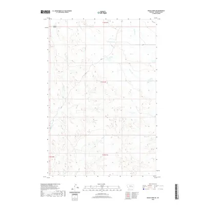
2020 Map of Rough Creek NE
USGS Topo · Published 2020About this map
Trail Cr Reservoir sits at the heart of this drainage-rich landscape in Rosebud County, where the topography is defined by an intricate network of intermittent waterways and coulees. The map illustrates the complex watershed management of the high plains, showing how Trail Cr and Coal Cr carve through the terrain, flanked by numerous small upland draws. Human influence on the land is marked primarily by ranch roads like Rd 203 and Killen Rd, which follow the contours of the drainage divides. The survey meticulously documents the distinct channels of Ryans Fork, Upper Coal Cr, and the northern reaches of Rough Cr, providing a clear picture of the hydrological patterns and land partitions in this portion of eastern Montana.
Find a feature on this map
14 named features on this map. Tap any name to fly to it.
Don’t see what you’re looking for? This feature index may not catch every label — zoom into the map to look around manually.
Map Details
Editions of this 2020 Rough Creek NE Map
This is the sole edition of this map. No revisions or reprints were ever made.
Other maps of this area

1954 · Forsyth
USGS Topo · 1:250,000

1957 · Forsyth
USGS Topo · 1:250,000

1958 · Forsyth
USGS Topo · 1:250,000

1965 · Needle Butte Reservoir
USGS Topo · 1:24,000

1965 · Needle Butte
USGS Topo · 1:24,000

1965 · Clear Water Reservoir
USGS Topo · 1:24,000

1969 · Van Burton Creek
USGS Topo · 1:24,000

1969 · Rudie Coulee
USGS Topo · 1:24,000

1969 · Wild Horse Pass
USGS Topo · 1:24,000
1969 · Rough Creek SE
USGS Topo · 1:24,000