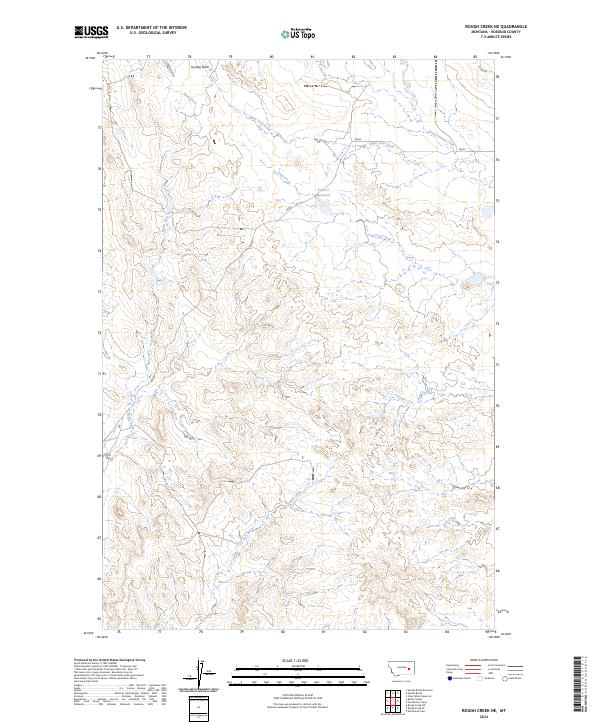
2024 Map of Rough Creek NE
USGS Topo · Published 2024About this map
Sunday Butte stands as a prominent landmark in this eastern Montana landscape, overlooking a complex network of seasonal drainages and cattle country infrastructure. The terrain is defined by the headwaters of several systems, including the westward-flowing Ryans Fork and the eastward-trending South Sunday Creek. Water management in this arid environment is evidenced by the presence of the Trail Cr Reservoir, a critical point for local land use and livestock.
Find a feature on this map
16 named features on this map. Tap any name to fly to it.
Don’t see what you’re looking for? This feature index may not catch every label — zoom into the map to look around manually.
Map Details
Editions of this 2024 Rough Creek NE Map
This is the sole edition of this map. No revisions or reprints were ever made.
Other maps of this area

1954 · Forsyth
USGS Topo · 1:250,000

1957 · Forsyth
USGS Topo · 1:250,000

1958 · Forsyth
USGS Topo · 1:250,000

1965 · Needle Butte Reservoir
USGS Topo · 1:24,000

1965 · Needle Butte
USGS Topo · 1:24,000

1965 · Clear Water Reservoir
USGS Topo · 1:24,000

1969 · Van Burton Creek
USGS Topo · 1:24,000

1969 · Rudie Coulee
USGS Topo · 1:24,000

1969 · Wild Horse Pass
USGS Topo · 1:24,000
1969 · Rough Creek SE
USGS Topo · 1:24,000