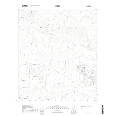
2019 Map of Rough Hollow
USGS Topo · Published 2019About this map
Mt Sharp rises as a prominent landmark in this corner of the Texas Hill Country, where the landscape is defined by the headwaters of the Blanco River and its various tributaries. The map documents a mix of rural ranch lands and modern residential development, particularly concentrated around the Cypress Creek drainage and the distinctive Jacobs Well Spring. Local history is anchored by several family and community burial grounds, including the Mount Sharp Cem and Gatlin - Garrett Cem, which sit among high points like Peach Mtn and Jack Mtn. The terrain is deeply incised by drainages such as Cat Hollow, Elm Hollow, and the namesake Rough Hollow. The network of roads, including Ranch Rd 2325 and Fischer Store Rd, illustrates the connectivity between these highland ridges and the creek valleys that feed into the larger river system.
Find a feature on this map
99 named features on this map. Tap any name to fly to it.
Don’t see what you’re looking for? This feature index may not catch every label — zoom into the map to look around manually.
Map Details
Editions of this 2019 Rough Hollow Map
This is the sole edition of this map. No revisions or reprints were ever made.
Other maps of this area

1887 · Blanco
USGS Topo · 1:125,000

1894 · Blanco
USGS Topo · 1:125,000

1920 · Smithsons Valley
USGS Topo · 1:62,500

1925 · Smithson Valley No. 1
USGS Topo · 1:48,000

1927 · Smithson Valley
USGS Topo · 1:62,500

1929 · Hunter
USGS Topo · 1:62,500

1929 · Smithson Valley
USGS Topo · 1:62,500

1940 · Smithson Valley
USGS Topo · 1:62,500

1954 · Llano
USGS Topo · 1:250,000

1954 · San Antonio
USGS Topo · 1:250,000