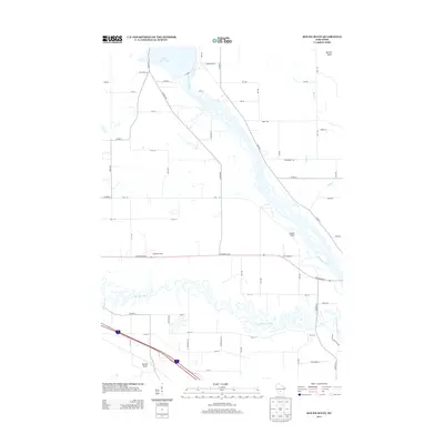
2013 Map of Round Bluff
USGS Topo · Published 2013About this map
Castle Rock Lake and the braided channels of the Wisconsin River dominate this landscape south of Quincy Bluff. The map illustrates a distinctive hydrographic pattern where the Lemonweir River meanders sharply through the southern territory, eventually approaching the larger river system near Castle Rock. Settlement is characterized by localized nodes like Woodside Ranch and the namesake Round Bluff, connected by a network of county highways and rural roads including Co Hwy-G and Co Hwy-Z. The transition from the sprawling reservoir to the complex river bottoms highlights the area's role as a drainage corridor, with numerous small tributaries such as Duck Cr and Sevenmile Cr feeding into the primary waterways.
Find a feature on this map
58 named features on this map. Tap any name to fly to it.
Don’t see what you’re looking for? This feature index may not catch every label — zoom into the map to look around manually.
Map Details
Editions of this 2013 Round Bluff Map
This is the sole edition of this map. No revisions or reprints were ever made.
Other maps of this area

1901 · The Dells
USGS Topo · 1:62,500

1921 · Mauston
USGS Topo · 1:62,500

1956 · Reedsburg
USGS Topo · 1:62,500

1957 · Wisconsin Dells
USGS Topo · 1:62,500

1957 · Madison
USGS Topo · 1:250,000

1958 · La Crosse
USGS Topo · 1:250,000

1960 · Madison
USGS Topo · 1:250,000

1961 · La Crosse
USGS Topo · 1:250,000

1961 · Adams
USGS Topo · 1:62,500

1962 · Mauston
USGS Topo · 1:62,500