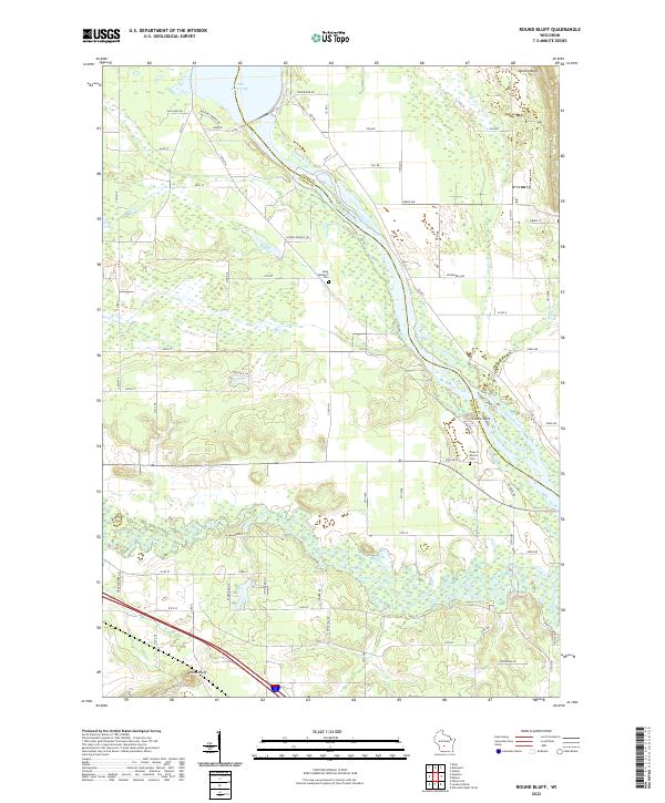
2022 Map of Round Bluff
USGS Topo · Published 2022About this map
Wisconsin River and Lemonweir River define this central Wisconsin landscape, where the border of Adams and Juneau counties follows the serpentine path of the water. The map shows the transition from the open waters of Castle Rock Lake in the north down toward the rocky elevations of Quincy Bluff and the namesake Round Bluff. Small settlements and rural roads reflect a community built around these waterways and the surrounding terrain. Genealogists will find the locations of Saint Michaels Cem and the Town of Marion Cem particularly valuable for tracing local family history. The network of rural routes, including Co Rd HH and Huskers Rd, connects the scattered homesites of Castle Rock to the larger river systems that have long dominated the regional economy and layout.
Find a feature on this map
66 named features on this map. Tap any name to fly to it.
Don’t see what you’re looking for? This feature index may not catch every label — zoom into the map to look around manually.
Map Details
Editions of this 2022 Round Bluff Map
This is the sole edition of this map. No revisions or reprints were ever made.
Other maps of this area

1901 · The Dells
USGS Topo · 1:62,500

1921 · Mauston
USGS Topo · 1:62,500

1956 · Reedsburg
USGS Topo · 1:62,500

1957 · Wisconsin Dells
USGS Topo · 1:62,500

1957 · Madison
USGS Topo · 1:250,000

1958 · La Crosse
USGS Topo · 1:250,000

1960 · Madison
USGS Topo · 1:250,000

1961 · La Crosse
USGS Topo · 1:250,000

1961 · Adams
USGS Topo · 1:62,500

1962 · Mauston
USGS Topo · 1:62,500