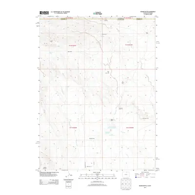
2013 Map of Round Butte
USGS Topo · Published 2013About this map
Rawhide Flats stretches across this borderlands landscape where Colorado and Wyoming meet. The 2013 survey illustrates a high-plains environment characterized by specialized livestock or research outposts, including Soapstone Camp, Brannigan Camp, and Castle Rock Camp. Water management is central to the land's utility, evidenced by the Mountain Supply Reservoir Number 1 and Round Butte Reservoir situated near the landmark Round Butte. The drainage patterns of Rawhide Creek, Sand Creek, and Spottlewood Creek carve through the terrain, supporting isolated springs like Soapstone Springs and the tiered Jack Springs Camp system. This map captures the intersection of Larimer and Laramie counties, reflecting a contemporary ranching or conservation layout defined by private drives such as Rodeo Hills Ln and the expansive open range of the northern Front Range foothills.
Find a feature on this map
31 named features on this map. Tap any name to fly to it.
Don’t see what you’re looking for? This feature index may not catch every label — zoom into the map to look around manually.
Map Details
Editions of this 2013 Round Butte Map
This is the sole edition of this map. No revisions or reprints were ever made.
Other maps of this area

1905 · Sherman
USGS Topo · 1:125,000

1907 · Livermore
USGS Topo · 1:125,000

1908 · Eaton
USGS Topo · 1:125,000

1909 · Livermore
USGS Topo · 1:125,000

1910 · Eaton
USGS Topo · 1:125,000

1911 · Cheyenne
USGS Topo · 1:125,000

1914 · Cheyenne
USGS Topo · 1:125,000

1950 · Cheyenne
USGS Topo · 1:62,500

1954 · Cheyenne
USGS Topo · 1:250,000

1954 · Greeley
USGS Topo · 1:250,000