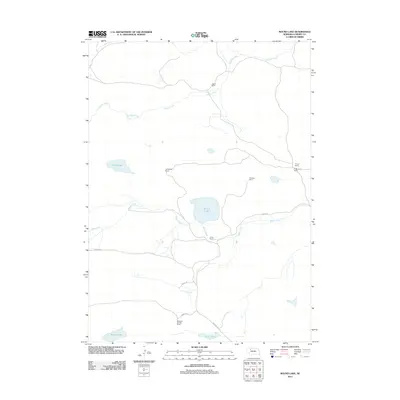
2011 Map of Round Lake
USGS Topo · Published 2011About this map
The expansive ranchlands of Cherry County define this Nebraska landscape, where family operations are centered around isolated water sources in the Sandhills. Named features like Abbott Ranch, Carver Ranch, and the Marshall and Son Ranch illustrate a settlement pattern based on large-scale grazing. The hydrology of the region is vital, with Round Lake serving as a central landmark alongside smaller basins like Goose Lake and Murphy Lake.
Find a feature on this map
17 named features on this map. Tap any name to fly to it.
Don’t see what you’re looking for? This feature index may not catch every label — zoom into the map to look around manually.
Map Details
Editions of this 2011 Round Lake Map
This is the sole edition of this map. No revisions or reprints were ever made.
Other maps of this area

1949 · Steverson Lake
USGS Topo · 1:62,500

1950 · Doughboy
USGS Topo · 1:62,500

1950 · Wolf Lake
USGS Topo · 1:62,500

1951 · Steverson Lake
USGS Topo · 1:62,500

1951 · Wolf Lake
USGS Topo · 1:62,500

1951 · Merriman 4
USGS Topo · 1:62,500

1952 · Doughboy
USGS Topo · 1:62,500

1957 · Valentine
USGS Topo · 1:250,000

1959 · Valentine
USGS Topo · 1:250,000

1985 · Mullen
USGS Topo · 1:100,000