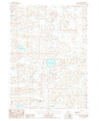
1987 Map of Round Lake
USGS Topo · Published 1987About this map
The Arkansas Valley of northern Cherry County is defined here by a sparse landscape of remote cattle operations and intermittent water bodies. In the mid-1980s, the ranching economy centered around several named homesteads including Abbott Ranch, Thayer Ranch, and Marshall Ranch. These outposts are connected by a network of 4WD trails, reflecting the isolated nature of the Sandhills terrain during this era. Educational infrastructure for the surrounding families is represented by the isolated School No 170, located south of Round Lake. The drainage of Gordon Creek and several distinct basins, such as Goose Lake and Silver Lake, provide the primary topographical relief in an area where flowing wells indicate the vital presence of the underlying aquifer.
Find a feature on this map
17 named features on this map. Tap any name to fly to it.
Don’t see what you’re looking for? This feature index may not catch every label — zoom into the map to look around manually.
Map Details
Editions of this 1987 Round Lake Map
This is the sole edition of this map. No revisions or reprints were ever made.
Other maps of this area

1949 · Steverson Lake
USGS Topo · 1:62,500

1950 · Doughboy
USGS Topo · 1:62,500

1950 · Wolf Lake
USGS Topo · 1:62,500

1951 · Steverson Lake
USGS Topo · 1:62,500

1951 · Wolf Lake
USGS Topo · 1:62,500

1951 · Merriman 4
USGS Topo · 1:62,500

1952 · Doughboy
USGS Topo · 1:62,500

1957 · Valentine
USGS Topo · 1:250,000

1959 · Valentine
USGS Topo · 1:250,000

1985 · Mullen
USGS Topo · 1:100,000