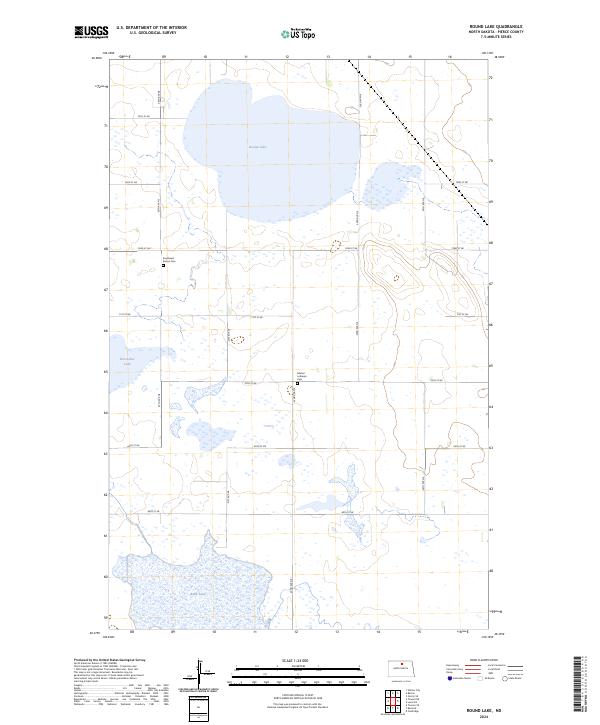
2024 Map of Round Lake
USGS Topo · Published 2024About this map
Round Lake and the surrounding prairie wetlands dominate this portion of the North Dakota landscape on the border of McHenry County Waterfowl Production Area and Pierce County. The terrain is defined by its glacial potholes and waterfowl habitats, which are protected by large federal conservation zones. Scattered throughout the section lines are remnants of the area's rural history and early settlement patterns, most notably at the Southwest Barton Cem and Marker Lutheran Cem. These small burial grounds serve as the primary local markers of the families who established farms in this region of the Drift Prairie. A strict grid of section roads, including 72nd St NE and 22nd Ave NE, provides access through the marshy landscape, connecting isolated water bodies like Horseshoe Lake and Rush Lake within the Pierce County Waterfowl Production Area.
Find a feature on this map
23 named features on this map. Tap any name to fly to it.
Don’t see what you’re looking for? This feature index may not catch every label — zoom into the map to look around manually.
Map Details
Editions of this 2024 Round Lake Map
This is the sole edition of this map. No revisions or reprints were ever made.
Other maps of this area

1954 · Tunbridge
USGS Topo · 1:24,000

1954 · Towner NE
USGS Topo · 1:24,000

1954 · Overly SE
USGS Topo · 1:24,000

1954 · Barton
USGS Topo · 1:24,000

1954 · Berwick
USGS Topo · 1:24,000

1954 · Round Lake
USGS Topo · 1:24,000

1954 · Leverich
USGS Topo · 1:24,000

1954 · Willow City
USGS Topo · 1:24,000

1954 · Towner SE
USGS Topo · 1:24,000

1954 · Minot
USGS Topo · 1:250,000