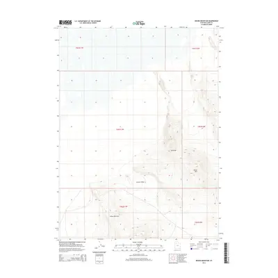
2014 Map of Round Mountain
USGS Topo · Published 2014About this map
Grassy Mountains and the elevated terrain of Tank Ridge dominate this interior portion of Box Elder County. The topography here is defined by sharp elevation changes, with Round Mtn standing as a prominent landmark overlooking the broader basin. This 2014 survey reveals a landscape largely shaped by its geologic character rather than human infrastructure, as seen in the wide expanse of German Valley. The map detail captures the intersection of several townships, including t4n r11w and t4n r10w, providing an essential grid for understanding land ownership and grazing boundaries in this high-desert environment. For those studying the physical geography of northwestern Utah, the contour intervals provide a clear picture of the land's natural drainage and ridge systems.
Find a feature on this map
10 named features on this map. Tap any name to fly to it.
Don’t see what you’re looking for? This feature index may not catch every label — zoom into the map to look around manually.
Map Details
Editions of this 2014 Round Mountain Map
This is the sole edition of this map. No revisions or reprints were ever made.
Other maps of this area

1885 · Tooele Valley
USGS Topo · 1:250,000

1953 · Tooele
USGS Topo · 1:250,000

1954 · Brigham City
USGS Topo · 1:250,000

1955 · Tooele
USGS Topo · 1:250,000

1958 · Brigham City
USGS Topo · 1:250,000

1962 · Brigham City
USGS Topo · 1:250,000

1969 · Hogup Ridge South
USGS Topo · 1:24,000

1969 · Strongs Knob
USGS Topo · 1:24,000

1973 · Grassy Mountains
USGS Topo · 1:24,000

1973 · Finger Ridge
USGS Topo · 1:24,000