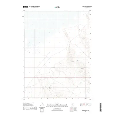
2020 Map of Round Mountain
USGS Topo · Published 2020About this map
Grassy Mountains and the prominent peak of Round Mtn anchor the high desert terrain within Box Elder County, Utah. This 2020 landscape illustrates the isolation of the Great Basin, where structural landforms like Tank Ridge overlook the broad, flat expanse of German Valley. The cartography reveals a stark environment defined by elevation and drainage patterns rather than human settlement, reflecting the remote character of this corner of northern Utah. Sparse road networks and the lack of named structures highlight the area's preservation as an open landscape, providing a clear record of the region's topography for modern geographic study.
Find a feature on this map
5 named features on this map. Tap any name to fly to it.
Don’t see what you’re looking for? This feature index may not catch every label — zoom into the map to look around manually.
Map Details
Editions of this 2020 Round Mountain Map
This is the sole edition of this map. No revisions or reprints were ever made.
Other maps of this area

1885 · Tooele Valley
USGS Topo · 1:250,000

1953 · Tooele
USGS Topo · 1:250,000

1954 · Brigham City
USGS Topo · 1:250,000

1955 · Tooele
USGS Topo · 1:250,000

1958 · Brigham City
USGS Topo · 1:250,000

1962 · Brigham City
USGS Topo · 1:250,000

1969 · Hogup Ridge South
USGS Topo · 1:24,000

1969 · Strongs Knob
USGS Topo · 1:24,000

1973 · Grassy Mountains
USGS Topo · 1:24,000

1973 · Finger Ridge
USGS Topo · 1:24,000