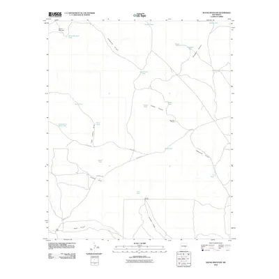
2010 Map of Round Mountain
USGS Topo · Published 2010About this map
Round Mountain rises as a prominent landmark in this ranching landscape of eastern Chaves County, where water management is the primary shaper of the terrain. The presence of Yoder Ranch in the southwest and a network of named livestock tanks like Mikes Tank, Pacheco Tank, and South Tank underscore the area's grazing history. Natural drainage patterns are dominated by the winding paths of Fifteenmile Arroyo and Gallo Arroyo, while deep incisions like Threadgill Canyon and Cistern Canyon cut through the high plains. Essential infrastructure for this arid environment is evident in the inclusion of the Fifteenmile Windmill and Boswell Windmill, which served the local cattle operations. Settlement is sparse, with primary access provided by the unpaved stretches of Purslane Rd and Stargrass Rd, which connect remote watering points like the Government Water Hole and various family-named features.
Find a feature on this map
28 named features on this map. Tap any name to fly to it.
Don’t see what you’re looking for? This feature index may not catch every label — zoom into the map to look around manually.
Map Details
Editions of this 2010 Round Mountain Map
This is the sole edition of this map. No revisions or reprints were ever made.
Other maps of this area

1954 · Fort Sumner
USGS Topo · 1:250,000

1955 · Roswell
USGS Topo · 1:250,000

1958 · Fort Sumner
USGS Topo · 1:250,000

1958 · Roswell
USGS Topo · 1:250,000

1962 · Roswell
USGS Topo · 1:250,000

1967 · Wire Lake
USGS Topo · 1:24,000

1967 · Round Mountain SE
USGS Topo · 1:24,000

1967 · North Lake
USGS Topo · 1:24,000

1967 · Round Mountain
USGS Topo · 1:24,000

1967 · Chivata Canyon
USGS Topo · 1:24,000