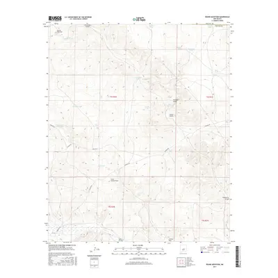
2017 Map of Round Mountain
USGS Topo · Published 2017About this map
Round Mountain anchors this high-desert landscape in Chaves County, where water management is the primary signature of land use. The terrain is defined by a network of drainage systems including Fifteenmile Arroyo, Little Cowboy Draw, and the winding Gallo Arroyo. Life in this arid region centers on scattered tanks and catchments such as Government Tank, Boulder Tank, and Akins Tank. These water sources, alongside the curiously named Government Water Hole, reveal the infrastructure required for ranching and survival in the New Mexico backcountry. Navigation through the canyons, like Threadgill Canyon and Cistern Canyon, is facilitated by a grid of rural tracks including Stargrass Rd and Purslane Rd. The map illustrates the stark intersection of natural topography and the Public Land Survey System during the early twenty-first century.
Find a feature on this map
31 named features on this map. Tap any name to fly to it.
Don’t see what you’re looking for? This feature index may not catch every label — zoom into the map to look around manually.
Map Details
Editions of this 2017 Round Mountain Map
This is the sole edition of this map. No revisions or reprints were ever made.
Other maps of this area

1954 · Fort Sumner
USGS Topo · 1:250,000

1955 · Roswell
USGS Topo · 1:250,000

1958 · Fort Sumner
USGS Topo · 1:250,000

1958 · Roswell
USGS Topo · 1:250,000

1962 · Roswell
USGS Topo · 1:250,000

1967 · Wire Lake
USGS Topo · 1:24,000

1967 · Round Mountain SE
USGS Topo · 1:24,000

1967 · North Lake
USGS Topo · 1:24,000

1967 · Round Mountain
USGS Topo · 1:24,000

1967 · Chivata Canyon
USGS Topo · 1:24,000