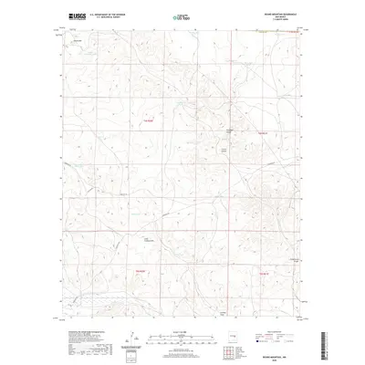
2020 Map of Round Mountain
USGS Topo · Published 2020About this map
Round Mtn anchors the northern reaches of this high-desert landscape in Chaves County, characterized by a complex network of canyons and arroyos. This 2020 survey illustrates a region defined by its water management, where numerous catchment features like Pacheco Tank, Broom Tank, and the Government Water Hole are critical landmarks. These dispersed water sources suggest the area's continued utility for livestock and land management within the Public Land Survey System grids of T3S through T5S.
Find a feature on this map
32 named features on this map. Tap any name to fly to it.
Don’t see what you’re looking for? This feature index may not catch every label — zoom into the map to look around manually.
Map Details
Editions of this 2020 Round Mountain Map
This is the sole edition of this map. No revisions or reprints were ever made.
Other maps of this area

1954 · Fort Sumner
USGS Topo · 1:250,000

1955 · Roswell
USGS Topo · 1:250,000

1958 · Fort Sumner
USGS Topo · 1:250,000

1958 · Roswell
USGS Topo · 1:250,000

1962 · Roswell
USGS Topo · 1:250,000

1967 · Wire Lake
USGS Topo · 1:24,000

1967 · Round Mountain SE
USGS Topo · 1:24,000

1967 · North Lake
USGS Topo · 1:24,000

1967 · Round Mountain
USGS Topo · 1:24,000

1967 · Chivata Canyon
USGS Topo · 1:24,000