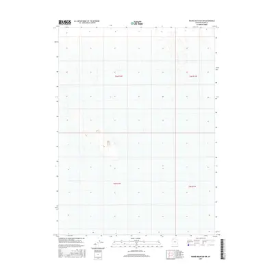
2017 Map of Round Mountain NW
USGS Topo · Published 2017About this map
Grid lines and township boundaries define this corner of Box Elder County, showing the intersection of T6n R12w and T6n R11w in the northern half, and T5n R12w meeting T5n R11w to the south. The landscape is characterized by its relative emptiness, marked primarily by the Public Land Survey System divisions. In this 2017 survey, the terrain data reveals subtle topographic variations through fine contour lines, while the absence of named settlements or infrastructure highlights the undeveloped nature of the area. The map serves as a detailed record of land management divisions in a quiet part of northwestern Utah, where the topography and township boundaries are the primary features of the land.
Find a feature on this map
4 named features on this map. Tap any name to fly to it.
Don’t see what you’re looking for? This feature index may not catch every label — zoom into the map to look around manually.
Map Details
Editions of this 2017 Round Mountain NW Map
This is the sole edition of this map. No revisions or reprints were ever made.
Other maps of this area

1954 · Brigham City
USGS Topo · 1:250,000

1958 · Brigham City
USGS Topo · 1:250,000

1962 · Brigham City
USGS Topo · 1:250,000

1969 · Hogup Ridge South
USGS Topo · 1:24,000

1969 · Hogup Ridge North
USGS Topo · 1:24,000

1983 · Desert Peak
USGS Topo · 1:24,000

1983 · Round Mountain NW
USGS Topo · 1:24,000
1983 · Round Mountain SW
USGS Topo · 1:24,000

1983 · Groome
USGS Topo · 1:24,000
1983 · Round Mountain
USGS Topo · 1:24,000