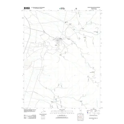
2011 Map of Round Mountain
USGS Topo · Published 2011About this map
Round Mountain stands as the central hub of this Nevada landscape, where the town's industrial character is defined by the proximity of the Stebbins Mill and the Round Mountain Post Office. The surrounding terrain in Nye County is deeply etched by a network of steep drainages, including Jefferson Canyon to the north and the rugged Shoshone Canyon that cuts through the center. These canyons reveal the historic importance of water and ore processing in the region, evidenced by the Steigmeyer Mill located along Jefferson Creek. To the south, the landscape transitions toward Says Ranch and Mariposa Creek, while more remote corridors like Captured Canyon and Slaughterhouse Canyon suggest the difficult topography that miners and ranchers navigated. A complex web of specialized roads, such as Mine RD and Jett Canyon RD, connects the various milling operations and canyons, illustrating the enduring footprint of mining activity in the Toiyabe National Forest area.
Find a feature on this map
29 named features on this map. Tap any name to fly to it.
Don’t see what you’re looking for? This feature index may not catch every label — zoom into the map to look around manually.
Map Details
Editions of this 2011 Round Mountain Map
This is the sole edition of this map. No revisions or reprints were ever made.
Other maps of this area

1907 · Tonopah
USGS Topo · 1:250,000

1908 · Tonopah
USGS Topo · 1:250,000

1956 · Tonopah
USGS Topo · 1:250,000

1959 · Tonopah
USGS Topo · 1:250,000

1962 · Tonopah
USGS Topo · 1:250,000

1971 · Carvers
USGS Topo · 1:24,000

1971 · Seyler Peak
USGS Topo · 1:24,000

1971 · Manhattan
USGS Topo · 1:24,000

1971 · Pablo Canyon Ranch
USGS Topo · 1:24,000

1971 · Belmont West
USGS Topo · 1:24,000