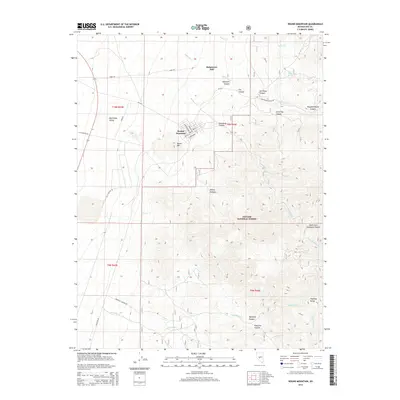
2014 Map of Round Mountain
USGS Topo · Published 2014About this map
Round Mountain sits at the foot of the Toquima Range in Nye County, Nevada, serving as a focal point for the region’s industrial and natural geography. The landscape is defined by the sharp transition between the Big Smoky Valley to the west and the high-elevation canyons of the Toiyabe National Forest to the east. Evidence of the area's processing history is visible at the Steigmeyer Mill, while a complex network of canyons—including Jefferson Canyon, Shoshone Canyon, and Slaughterhouse Canyon—carve through the mountains. This 2014 survey records the modern street grid of Round Mountain, featuring Davis St, Grove St, and Jefferson St, alongside remote water sources like Ink House Spring. The map captures the significant elevation changes that define the eastern Great Basin, from the desert valley floor to the prominent peak of Round Mtn.
Find a feature on this map
39 named features on this map. Tap any name to fly to it.
Don’t see what you’re looking for? This feature index may not catch every label — zoom into the map to look around manually.
Map Details
Editions of this 2014 Round Mountain Map
This is the sole edition of this map. No revisions or reprints were ever made.
Other maps of this area

1907 · Tonopah
USGS Topo · 1:250,000

1908 · Tonopah
USGS Topo · 1:250,000

1956 · Tonopah
USGS Topo · 1:250,000

1959 · Tonopah
USGS Topo · 1:250,000

1962 · Tonopah
USGS Topo · 1:250,000

1971 · Carvers
USGS Topo · 1:24,000

1971 · Seyler Peak
USGS Topo · 1:24,000

1971 · Manhattan
USGS Topo · 1:24,000

1971 · Pablo Canyon Ranch
USGS Topo · 1:24,000

1971 · Belmont West
USGS Topo · 1:24,000