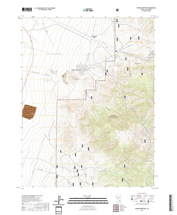
2021 Map of Round Mountain
USGS Topo · Published 2021About this map
Round Mountain sits at the foot of the Toquima Range in this modern-era survey of central Nevada. The geography is defined by the transition from the wide, level expanse of the Big Smoky Valley into the deeply incised drainages of the Toiyabe National Forest. Industrial history is represented by the Steigmeyer Mill, located north of the settlement near Jefferson Creek. The map provides a detailed view of the local road network servicing the area's mining interests, including Smokey Valley Mine Road and Jetty Canyon Road. Water sources, critical in this arid landscape, are documented through named features like Ink House Spring and the drainage systems of Jefferson Canyon, Shoshone Canyon, and Mariposa Canyon. This survey captures the town and its surrounding wilderness before recent shifts in land use and mining expansion.
Find a feature on this map
37 named features on this map. Tap any name to fly to it.
Don’t see what you’re looking for? This feature index may not catch every label — zoom into the map to look around manually.
Map Details
Editions of this 2021 Round Mountain Map
This is the sole edition of this map. No revisions or reprints were ever made.
Other maps of this area

1907 · Tonopah
USGS Topo · 1:250,000

1908 · Tonopah
USGS Topo · 1:250,000

1956 · Tonopah
USGS Topo · 1:250,000

1959 · Tonopah
USGS Topo · 1:250,000

1962 · Tonopah
USGS Topo · 1:250,000

1971 · Carvers
USGS Topo · 1:24,000

1971 · Seyler Peak
USGS Topo · 1:24,000

1971 · Manhattan
USGS Topo · 1:24,000

1971 · Pablo Canyon Ranch
USGS Topo · 1:24,000

1971 · Belmont West
USGS Topo · 1:24,000