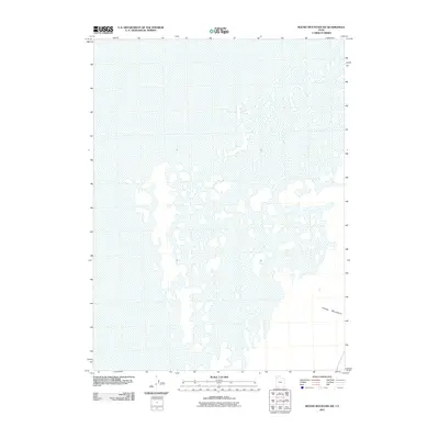
2011 Map of Round Mountain SW
USGS Topo · Published 2011About this map
Grassy Mountains define the southeastern corner of this landscape in Box Elder County, which is dominated by the sprawling, intricate patterns of the Great Salt Lake desert. The 2011 survey by the U.S. Geological Survey utilizes hydrographic data and imagery to illustrate the complex network of mudflats and seasonal water features that characterize this arid basin. This specific area represents the quiet, uninhabited stretches of western Utah where the topography is defined more by the absence of permanent water than by human development. The contrast between the elevated terrain of the mountains and the level expanse of the surrounding flats highlights the stark geological transitions common to the eastern edge of the Great Basin.
Find a feature on this map
1 named feature on this map. Tap any name to fly to it.
Don’t see what you’re looking for? This feature index may not catch every label — zoom into the map to look around manually.
Map Details
Editions of this 2011 Round Mountain SW Map
This is the sole edition of this map. No revisions or reprints were ever made.
Other maps of this area

1953 · Tooele
USGS Topo · 1:250,000

1954 · Brigham City
USGS Topo · 1:250,000

1955 · Tooele
USGS Topo · 1:250,000

1958 · Brigham City
USGS Topo · 1:250,000

1962 · Brigham City
USGS Topo · 1:250,000

1969 · Hogup Ridge South
USGS Topo · 1:24,000

1973 · Grassy Mountains
USGS Topo · 1:24,000

1973 · Knolls 2 NE
USGS Topo · 1:24,000

1973 · Finger Ridge
USGS Topo · 1:24,000
1979 · Bonneville Salt Flats
USGS Topo · 1:100,000