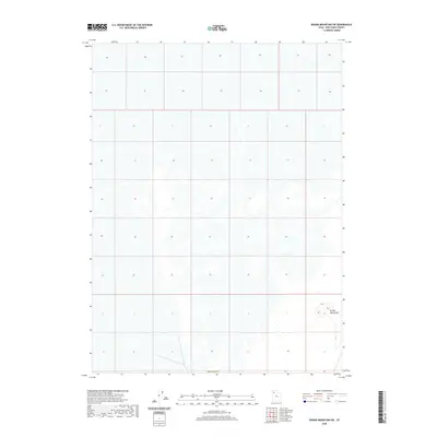
2020 Map of Round Mountain SW
USGS Topo · Published 2020About this map
The Grassy Mountains rise in the southeastern portion of this landscape, marking a significant change in elevation within the otherwise low-lying terrain of Box Elder Co. This survey illustrates the land division system across the region, where the grid of sections and townships remains the primary defining feature of the landscape. As a modern 2020 record, it provides precise topographical data for this part of Utah, focusing on the natural contours and drainage patterns where few human settlements or infrastructure developments are noted on the surface.
Find a feature on this map
2 named features on this map. Tap any name to fly to it.
Don’t see what you’re looking for? This feature index may not catch every label — zoom into the map to look around manually.
Map Details
Editions of this 2020 Round Mountain SW Map
This is the sole edition of this map. No revisions or reprints were ever made.
Other maps of this area

1953 · Tooele
USGS Topo · 1:250,000

1954 · Brigham City
USGS Topo · 1:250,000

1955 · Tooele
USGS Topo · 1:250,000

1958 · Brigham City
USGS Topo · 1:250,000

1962 · Brigham City
USGS Topo · 1:250,000

1969 · Hogup Ridge South
USGS Topo · 1:24,000

1973 · Grassy Mountains
USGS Topo · 1:24,000

1973 · Knolls 2 NE
USGS Topo · 1:24,000

1973 · Finger Ridge
USGS Topo · 1:24,000
1979 · Bonneville Salt Flats
USGS Topo · 1:100,000