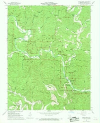
1967 Map of Round Spring
USGS Topo · Published 1970About this map
Round Spring State Park anchors this 1960s study of the Shannon County landscape, centered on the winding corridor of the Current River. This era marks the early years of the Ozark National Scenic Riverways, following its authorization in 1964 to preserve the unique riverine environment and its cold-water springs. The map reveals a deeply dissected terrain characterized by dozens of named hollows, including Mail Route Hollow and Pigeon Roost Hollow, which speak to the historic travel patterns and family settlements of the Missouri Ozarks.
Find a feature on this map
94 named features on this map. Tap any name to fly to it.
Don’t see what you’re looking for? This feature index may not catch every label — zoom into the map to look around manually.
Map Details
Editions of this 1967 Round Spring Map
4 editions found
Other maps of this area

1915 · Eminence
USGS Topo · 1:62,500

1917 · Eminence
USGS Topo · 1:62,500

1932 · Cedar Grove
USGS Topo · 1:48,000

1945 · Round Spring
USGS Topo · 1:62,500

1946 · Summersville
USGS Topo · 1:62,500

1947 · Sinkin
USGS Topo · 1:48,000

1948 · Summersville
USGS Topo · 1:62,500

1949 · Round Spring
USGS Topo · 1:62,500

1949 · Rolla
USGS Topo · 1:250,000

1951 · Cedargrove
USGS Topo · 1:24,000