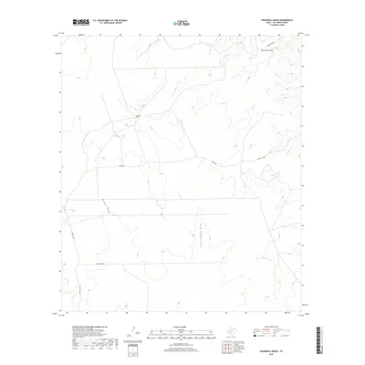
2019 Map of Roundhill Ranch
USGS Topo · Published 2019About this map
Roundhill Ranch anchors this high-desert landscape in Val Verde County, where the topography is defined by a network of ephemeral drainage systems. The terrain is marked by significant natural features such as Big Fielder Draw in the northeast and Henderson Draw to the south. The western portion of the map is dominated by the prominent Osman Draw and its smaller counterpart, Little Osman Draw.
Find a feature on this map
9 named features on this map. Tap any name to fly to it.
Don’t see what you’re looking for? This feature index may not catch every label — zoom into the map to look around manually.
Map Details
Editions of this 2019 Roundhill Ranch Map
This is the sole edition of this map. No revisions or reprints were ever made.
Other maps of this area

1943 · Malvado
USGS Topo · 1:62,500

1943 · Langtry
USGS Topo · 1:62,500

1944 · Malvado
USGS Topo · 1:62,500

1954 · Sonora
USGS Topo · 1:250,000

1958 · Sonora
USGS Topo · 1:250,000

1958 · Del Rio
USGS Topo · 1:250,000

1964 · Del Rio
USGS Topo · 1:250,000

1970 · Pandale
USGS Topo · 1:24,000

1970 · Little Fielder Draw
USGS Topo · 1:24,000
1973 · Harkell Canyon
USGS Topo · 1:24,000