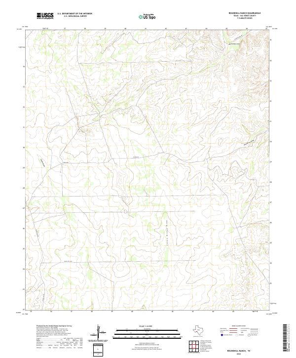
2022 Map of Roundhill Ranch
USGS Topo · Published 2022About this map
Val Verde County’s ranching frontier is defined by the complex network of intermittent drainages that carve through this arid landscape. The area is anchored by the prominent Osman Draw and its tributary Little Osman Draw, which run through the central and western portions of the quadrangle. In the northeast, Big Fielder Draw and Henderson Draw dictate the local topography, creating natural corridors through the terrain. Human presence is marked by a sparse but essential grid of rural routes, including Straub Rd and Ranch Rd 1865, which connect isolated ranching operations. The layout of these roads, such as Pumpville Rd, reflects the necessity of navigating around the deep draws and ridges typical of this part of West Texas, providing a clear look at how the environment shapes modern land use and access in a remote cattle-country setting.
Find a feature on this map
8 named features on this map. Tap any name to fly to it.
Don’t see what you’re looking for? This feature index may not catch every label — zoom into the map to look around manually.
Map Details
Editions of this 2022 Roundhill Ranch Map
This is the sole edition of this map. No revisions or reprints were ever made.
Other maps of this area

1943 · Malvado
USGS Topo · 1:62,500

1943 · Langtry
USGS Topo · 1:62,500

1944 · Malvado
USGS Topo · 1:62,500

1954 · Sonora
USGS Topo · 1:250,000

1958 · Sonora
USGS Topo · 1:250,000

1958 · Del Rio
USGS Topo · 1:250,000

1964 · Del Rio
USGS Topo · 1:250,000

1970 · Pandale
USGS Topo · 1:24,000

1970 · Little Fielder Draw
USGS Topo · 1:24,000
1973 · Harkell Canyon
USGS Topo · 1:24,000