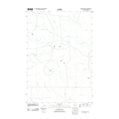
2012 Map of Roundup Butte
USGS Topo · Published 2012About this map
The N Fork Moreau River meanders across this Harding County landscape, carving through a high plains environment defined by its distinctive buttes and seasonal watercourses. Notable elevations such as Roundup Butte, the Ferguson Buttes, and the Davis Buttes provide significant local landmarks in an area dominated by cattle ranching and sparse human development. Named drainage features like Soft Water Draw and Stockade Draw suggest the historical importance of finding reliable water sources for livestock in this arid portion of South Dakota.
Find a feature on this map
15 named features on this map. Tap any name to fly to it.
Don’t see what you’re looking for? This feature index may not catch every label — zoom into the map to look around manually.
Map Details
Editions of this 2012 Roundup Butte Map
This is the sole edition of this map. No revisions or reprints were ever made.
Other maps of this area

1935 · Hoover
USGS Topo · 1:125,000

1935 · Harding
USGS Topo · 1:125,000

1954 · Lemmon
USGS Topo · 1:250,000

1957 · Lemmon
USGS Topo · 1:250,000

1973 · Lone Tree Draw East
USGS Topo · 1:24,000

1973 · Lone Tree Draw West
USGS Topo · 1:24,000

1973 · Redig
USGS Topo · 1:24,000
1977 · Granger Creek
USGS Topo · 1:24,000
1978 · Redig NE
USGS Topo · 1:24,000
1978 · Bams Butte NW
USGS Topo · 1:24,000