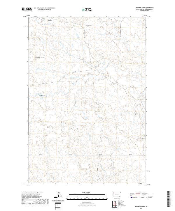
2021 Map of Roundup Butte
USGS Topo · Published 2021About this map
Roundup Butte and the surrounding high plains of Harding County define this landscape of the northern Missouri Plateau. The map area is dominated by the course of the N Fork Moreau River, which winds through the central portion of the sheet. This drainage system is supported by numerous seasonal draws and creeks, including Duck Cr, Second Sand Cr, and Goose Cr, illustrating the complex watershed of this arid region. The topography is punctuated by prominent landforms such as the Ferguson Buttes, Davis Buttes, and Dome Butte, which served as essential navigational landmarks for early settlers and travelers across the open range. A sparse network of rural routes, including Thompson Rd, Redig Rd, and Mason Rd, connects the distant ranching properties, following the natural contours of the land in a pattern typical of early twenty-first-century South Dakota cattle country.
Find a feature on this map
20 named features on this map. Tap any name to fly to it.
Don’t see what you’re looking for? This feature index may not catch every label — zoom into the map to look around manually.
Map Details
Editions of this 2021 Roundup Butte Map
This is the sole edition of this map. No revisions or reprints were ever made.
Other maps of this area

1935 · Hoover
USGS Topo · 1:125,000

1935 · Harding
USGS Topo · 1:125,000

1954 · Lemmon
USGS Topo · 1:250,000

1957 · Lemmon
USGS Topo · 1:250,000

1973 · Lone Tree Draw East
USGS Topo · 1:24,000

1973 · Lone Tree Draw West
USGS Topo · 1:24,000

1973 · Redig
USGS Topo · 1:24,000
1977 · Granger Creek
USGS Topo · 1:24,000
1978 · Redig NE
USGS Topo · 1:24,000
1978 · Bams Butte NW
USGS Topo · 1:24,000