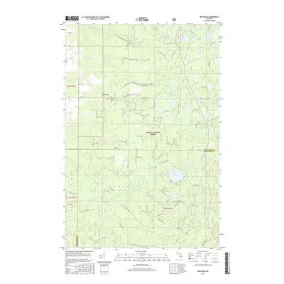
2017 Map of Rousseau
USGS Topo · Published 2017About this map
The settlement of Rousseau and the nearby Rousseau Cem stand as focal points in this section of the Ottawa National Forest. The landscape is defined by a dense network of hydrologic features, including the meandering W Br Firesteel River and several curiously named water bodies such as Sudden Lake and Very Sudden Pond. To the south, the small community of Pori lies near the intersection of Pori Cr and Pori Rd, illustrating the traditional Michigan Upper Peninsula pattern of small forest settlements linked by timber and transit routes.
Find a feature on this map
31 named features on this map. Tap any name to fly to it.
Don’t see what you’re looking for? This feature index may not catch every label — zoom into the map to look around manually.
Map Details
Editions of this 2017 Rousseau Map
This is the sole edition of this map. No revisions or reprints were ever made.
Other maps of this area

1949 · Rockland
USGS Topo · 1:62,500

1950 · Greenland
USGS Topo · 1:62,500

1951 · Rockland
USGS Topo · 1:62,500

1951 · Greenland
USGS Topo · 1:62,500

1954 · Rousseau
USGS Topo · 1:62,500

1954 · Winona
USGS Topo · 1:62,500

1958 · Iron River
USGS Topo · 1:250,000

1960 · Iron River
USGS Topo · 1:250,000

1961 · Iron River
USGS Topo · 1:250,000

1967 · Iron River
USGS Topo · 1:250,000