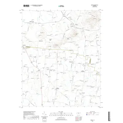
2019 Map of Rover
USGS Topo · Published 2019About this map
Eagleville sits on the western edge of this landscape where the Tennessee Valley Divide separates local drainages. The area is defined by a dense network of family-named cemeteries and crossroads settlements like Taylor Crossroads and Carter Crossroads, reflecting a deeply rooted agricultural community. Distinctive terrain features such as Byler Bottoms and Lamb Bottoms are prominent, while several knobs and hills like Versailles Knob and Pinnacle Hill rise above the surrounding valleys. Aviation history is visible through the Versailles Aerodrome and Hawk Haven Airfield, adding a layer of modern utility to the rural character. Genealogists will find an exceptional density of burial sites, including the Saint Paul Cem and numerous family plots like the Smotherman Cem and Nance Cem, scattered among the headwaters of the Harpeth River.
Find a feature on this map
182 named features on this map. Tap any name to fly to it.
Don’t see what you’re looking for? This feature index may not catch every label — zoom into the map to look around manually.
Map Details
Editions of this 2019 Rover Map
This is the sole edition of this map. No revisions or reprints were ever made.
Other maps of this area

1916 · Murfreesboro
USGS Topo · 1:62,500

1936 · Chapel Hill
USGS Topo · 1:24,000

1936 · Farmington
USGS Topo · 1:24,000

1936 · Rover
USGS Topo · 1:24,000

1936 · Deason
USGS Topo · 1:24,000

1936 · Unionville
USGS Topo · 1:24,000

1936 · Fosterville
USGS Topo · 1:24,000

1942 · Lebanon
USGS Topo · 1:100,000

1944 · Shelbyville
USGS Topo · 1:100,000
1947 · Farmington
USGS Topo · 1:24,000