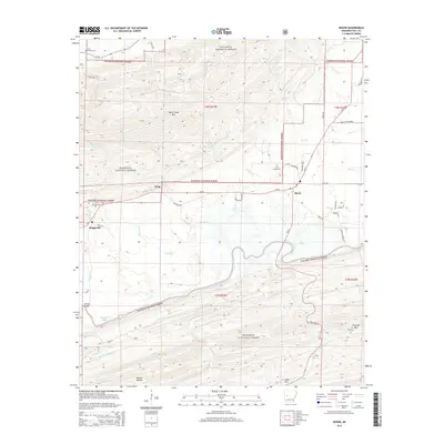
2014 Map of Rover
USGS Topo · Published 2014About this map
Rover and the surrounding Yell County landscape are defined by the winding course of the Fourche La Fave River and the northern reaches of the Ouachita National Forest. The 2014 terrain is structured by prominent ridges including Dutch Creek Mtn to the north and Fourche Mtn to the southeast, with settlements like Wing and Briggsville situated in the fertile valley between the heights. A significant portion of the southern area is dominated by the waters of Nimrod Lake, which stretches toward the western edge near the Whitely Bridge crossing.
Find a feature on this map
58 named features on this map. Tap any name to fly to it.
Don’t see what you’re looking for? This feature index may not catch every label — zoom into the map to look around manually.
Map Details
Editions of this 2014 Rover Map
This is the sole edition of this map. No revisions or reprints were ever made.
Other maps of this area

1879 · Mountain Home
USGS Topo · 1:62,500

1887 · Magazine Mountain #4
USGS Topo · 1:62,500

1887 · Magazine Mountain
USGS Topo · 1:62,500

1888 · Dardanelle #3
USGS Topo · 1:62,500

1890 · Magazine Mountain
USGS Topo · 1:125,000

1890 · Mount Ida
USGS Topo · 1:125,000

1890 · Hot Springs
USGS Topo · 1:125,000

1890 · Dardanelle
USGS Topo · 1:125,000

1894 · Hot Springs
USGS Topo · 1:125,000

1955 · Little Rock
USGS Topo · 1:250,000