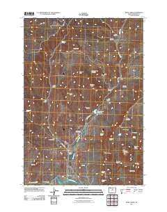
2011 Map of Rowe Creek
USGS Topo · Published 2011About this map
Sutton Ranch anchors a landscape of sharp relief and seasonal water sources in Wheeler County. The canyon-scored terrain is defined by the winding course of Rowe Creek, which feeds into the Rowe Creek Reservoir before eventually reaching the John Day River at Liberty Bottom. Significant elevation markers such as Kotzman Butte, Sugarloaf Mountain, and Thompson Butte punctuate the ridges, while numerous named canyons like Griffin Canyon and Thompson Canyon indicate the complex drainage patterns of the high desert. Local travel is facilitated by Rowe Creek Rd and Dry Hollow Rd, which navigate between prominent landforms like Kentucky Ridge and The Flat. For researchers, the map identifies specific water points essential to life in this arid region, including Mathieson Spring, Homestead Spring, and Rim Rock Springs.
Find a feature on this map
43 named features on this map. Tap any name to fly to it.
Don’t see what you’re looking for? This feature index may not catch every label — zoom into the map to look around manually.
Map Details
Editions of this 2011 Rowe Creek Map
This is the sole edition of this map. No revisions or reprints were ever made.
Other maps of this area

1926 · Mitchell
USGS Topo · 1:125,000

1955 · Bend
USGS Topo · 1:250,000

1957 · Bend
USGS Topo · 1:250,000

1958 · Bend
USGS Topo · 1:250,000

1966 · Mitchell
USGS Topo · 1:62,500

1966 · Kinzua
USGS Topo · 1:62,500

1966 · Clarno
USGS Topo · 1:62,500

1968 · Painted Hills
USGS Topo · 1:24,000

1981 · Stephenson Mountain
USGS Topo · 1:100,000
1987 · Rowe Creek
USGS Topo · 1:24,000