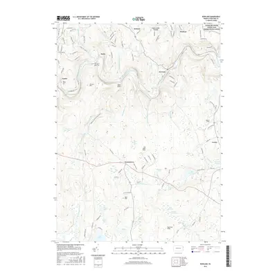
2016 Map of Rowland
USGS Topo · Published 2016About this map
The Lackawaxen River carves a deep valley through this corner of Pike County, passing the historical settlements of Rowland and Glen Eyre. This section of the river, part of the Upper Delaware Scenic and Recreational River corridor, is flanked by steep terrain features like Shimers Mtn and the industrial-era Shimers Rock Cut. The landscape transitions from the river valley to upland plateaus punctuated by numerous water bodies, including Lake Greeley, Sylvania Lake, and Killams Pond. Local history and genealogy are anchored by landmarks such as Mount Moriah Cem near Kimble and a network of small crossroad communities including Bohemia, Baoba, and Germantown. The layout of forest tracts like Fawn Lake Forest alongside traditional clearings like Boehm's Field illustrates the modern shift from timber and transit toward recreation and protected wilderness.
Find a feature on this map
111 named features on this map. Tap any name to fly to it.
Don’t see what you’re looking for? This feature index may not catch every label — zoom into the map to look around manually.
Map Details
Editions of this 2016 Rowland Map
This is the sole edition of this map. No revisions or reprints were ever made.
Other maps of this area

1913 · Milford
USGS Topo · 1:62,500

1915 · Milford
USGS Topo · 1:62,500

1920 · Damascus
USGS Topo · 1:62,500

1922 · White Lake
USGS Topo · 1:62,500

1923 · Damascus
USGS Topo · 1:62,500

1935 · Hawley
USGS Topo · 1:62,500

1938 · Hawley
USGS Topo · 1:62,500

1942 · White Lake
USGS Topo · 1:62,500

1943 · Honesdale
USGS Topo · 1:125,000

1943 · White Lake
USGS Topo · 1:62,500
Featured Places
- Lackawaxen Township, PA
- Blooming Grove Township, PA
- Palmyra Township, PA
- Bohemia, Lackawaxen Township
- Friendly Acres, Lackawaxen Township