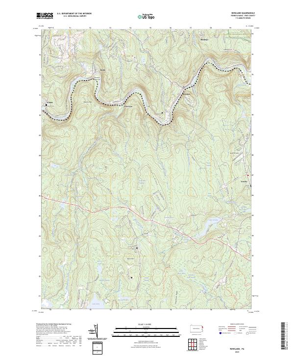
2023 Map of Rowland
USGS Topo · Published 2023About this map
The Lackawaxen River and its major tributaries define the movement of this Pike County landscape, carving through hills where Shimers Rock Cut and Shimers Mtn stand as prominent landmarks. The river valley serves as a historical corridor for small settlements like Glen Eyre, Baoba, and Kimble, which sit along the winding course of Towpath Rd. Further east, the village of Rowland occupies a bend in the river, while the upper reaches of the map are preserved by the Upper Delaware Scenic and Recreational River.
Find a feature on this map
112 named features on this map. Tap any name to fly to it.
Don’t see what you’re looking for? This feature index may not catch every label — zoom into the map to look around manually.
Map Details
Editions of this 2023 Rowland Map
This is the sole edition of this map. No revisions or reprints were ever made.
Other maps of this area

1913 · Milford
USGS Topo · 1:62,500

1915 · Milford
USGS Topo · 1:62,500

1920 · Damascus
USGS Topo · 1:62,500

1922 · White Lake
USGS Topo · 1:62,500

1923 · Damascus
USGS Topo · 1:62,500

1935 · Hawley
USGS Topo · 1:62,500

1938 · Hawley
USGS Topo · 1:62,500

1942 · White Lake
USGS Topo · 1:62,500

1943 · Honesdale
USGS Topo · 1:125,000

1943 · White Lake
USGS Topo · 1:62,500
Featured Places
- Lackawaxen Township, PA
- Blooming Grove Township, PA
- Palmyra Township, PA
- Bohemia, Lackawaxen Township
- Baoba, Lackawaxen Township