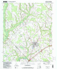
1997 Map of Rowland
USGS Topo · Published 2000About this map
Rowland stands as a central hub in the late 1990s, where the grid of the town meets the intricate swamp drainage systems of the North Carolina and South Carolina border. The landscape is defined by its numerous watercourses, including the Ashpole Swamp and Wilkinson Creek, which carve through the terrain between Robeson and Dillon Counties. This rural region is deeply anchored by its community institutions, with several legacy houses of worship such as Mt Pelier Ch, Ashpole Ch, and the Faith Lighthouse Tabernacle serving the surrounding countryside.
Find a feature on this map
39 named features on this map. Tap any name to fly to it.
Don’t see what you’re looking for? This feature index may not catch every label — zoom into the map to look around manually.
Map Details
Editions of this 1997 Rowland Map
This is the sole edition of this map. No revisions or reprints were ever made.
Other maps of this area

1943 · Pages Mill
USGS Topo · 1:62,500

1953 · Florence
USGS Topo · 1:250,000

1954 · Florence
USGS Topo · 1:250,000

1960 · Dillon East
USGS Topo · 1:24,000

1960 · Dillon West
USGS Topo · 1:24,000

1962 · Gaddysville
USGS Topo · 1:24,000

1962 · Fair Bluff
USGS Topo · 1:62,500

1971 · Minturn
USGS Topo · 1:24,000

1971 · Johns
USGS Topo · 1:24,000

1972 · Pembroke
USGS Topo · 1:24,000