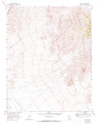
1969 Map of Rox NE
USGS Topo · Published 1990About this map
Mormon Mountains dominate the eastern reaches of this Lincoln County survey, culminating at the high point of Mormon Peak. The landscape is defined by its arid drainage systems, notably the Meadow Valley Wash in the northwest and Whitmore Wash to the south. Human presence in this high-desert environment is evidenced by sparse infrastructure and signs of historic activity, including scattered Prospect markings and unidentified Ruins situated in the higher elevations. The Union Pacific line cuts through the extreme corner of the map, following the low ground provided by the wash. A network of Jeep Trails and standard Trails provides the only access into the backcountry, connecting reliable water sources like Davies Spring to the surrounding peaks.
Find a feature on this map
10 named features on this map. Tap any name to fly to it.
Don’t see what you’re looking for? This feature index may not catch every label — zoom into the map to look around manually.
Map Details
Editions of this 1969 Rox NE Map
2 editions found
Other maps of this area

1885 · Pioche
USGS Topo · 1:250,000

1886 · Saint Thomas
USGS Topo · 1:250,000

1886 · Pioche
USGS Topo · 1:250,000

1893 · Saint Thomas
USGS Topo · 1:250,000

1954 · Caliente
USGS Topo · 1:250,000

1954 · Las Vegas
USGS Topo · 1:250,000

1957 · Las Vegas
USGS Topo · 1:250,000

1959 · Caliente
USGS Topo · 1:250,000

1959 · Las Vegas
USGS Topo · 1:250,000

1962 · Las Vegas
USGS Topo · 1:250,000