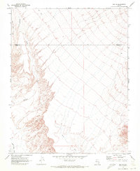
1969 Map of Rox SE
USGS Topo · Published 1972About this map
The Lincoln Co Clark Co boundary line divides this arid high-desert landscape, where the seasonal drainage of Meadow Valley Wash defines the southwestern corner of the terrain. Surveyed in the late 1960s, the map reveals a sparsely developed region primarily characterized by its natural hydrological features. Notable among these are Whitmore Wash and Weiser Wash, which carve through the land alongside a single Jeep Trail in the northern reaches. For those interested in early mining or mineral exploration in the Mojave, a lone Drill Hole is marked near the northwestern edge, serving as one of the few indicators of human industry within this expansive topographical study.
Find a feature on this map
6 named features on this map. Tap any name to fly to it.
Don’t see what you’re looking for? This feature index may not catch every label — zoom into the map to look around manually.
Map Details
Editions of this 1969 Rox SE Map
2 editions found
Other maps of this area

1886 · Saint Thomas
USGS Topo · 1:250,000

1893 · Saint Thomas
USGS Topo · 1:250,000

1954 · Las Vegas
USGS Topo · 1:250,000

1957 · Las Vegas
USGS Topo · 1:250,000

1958 · Moapa
USGS Topo · 1:62,500

1958 · Overton
USGS Topo · 1:62,500

1959 · Las Vegas
USGS Topo · 1:250,000

1962 · Las Vegas
USGS Topo · 1:250,000

1969 · Farrier
USGS Topo · 1:24,000
1969 · Rox
USGS Topo · 1:24,000